ALPE CAVANNA FROM LA BOSSOLA
Trail marker:
B11, B11a, montagna e cultura it. 7
Place of departure:
La Bossola, Netro (BI)
Place of arrival:
Alpe Cavanna
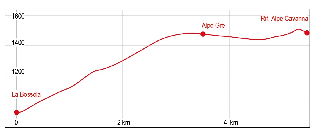
Departure altitude:
954 m
Arrival altitude:
1470 m
Duration:
1.30 hours for the ascent – 3 hours for the whole trip
Uphill height difference:
516 m
Type of excursion:
Family excursion, Trekking
Season:
Spring, Late spring/summer, Autumn
Netro (Elvo Valley)
Taste the spring amidst widespread blooms of gentian, crocus and narcissus, looking out from a panoramic balcony over the plain
Access and parking
From Biella follow the ring road westwards (signposted Ivrea - Mongrado), then follow the signs for Graglia, passing through Occhieppo Inferiore, Occhieppo Superiore, until you reach the Graglia Sanctuary. Leave the sanctuary on the left and follow the road. Continue until you reach a crossroads where the SP512 (Tracciolino) begins, at La Bossola. There is a bar and restaurant. Park your car.
Route
Easy hike mainly on gravel roads that lead from Bossola to the Alpe Cavanna alpine pasture in Valviona. There are beautiful views over the plain and, in particular, the area known as Pian della Morte. If walked in early spring, it is possible to admire the widespread flowering of gentians, crocus and narcissus.
After parking, follow the road to the right of the fork, in the direction of the San Carlo pass. A few metres further on you will start the hike. The road, partly asphalted, begins to gain height with a series of bends, with a moderate gradient, inside the beautiful wood of Netro. After a few hairpin bends, the route turns to the left, decreasing in gradient, until it reaches a first hairpin bend to the right and another to the left; the road loses gradient and begins a long traverse to the left. Do not take the road that climbs to the right, continue straight ahead (trail marker B11). You come to yet another hairpin bend to the right, ignore this as well, this road branches off to the left and leads to a nearby building, you rather continua on this same road until you come to the beginning of a trail (signposted itinerary 7). Following the red signs, go up along the trail, which is not very evident, until you come to a crossroads, where you turn right following the B11a trail marker; you will then reach Faggi Oscarone. Go past the building and soon you will come out on the track that goes up from the Bossola - Andrate road. Turn left and with a series of hairpin bends, you will quickly gain height, pass above some ruined farmhouses, leave the branch-off for Amburnero di Sotto on the right and turn left. You will soon reach the Alpone, where you take the road that climbs to the left. You arrive at the beautiful pastureland plateau of Pian della Morte, where you first pass the casere dell ‘Alpetto Superiore and then the building of the Alpe di Grè. Keep following the tractor-track road until you reach the watershed between the Grè and Viona valleys (illustrative panel). Follow the road until it crosses the gravel track that goes up to Ghizzetti and you will soon come to a fork. Turn left and descend directly towards the Cavanna buildings.
Descent along the ascent route.
References
Passeggiate sulle montagne del Biellese di Corrado Martiner Testa - Blu edizioni