THE ROUTE

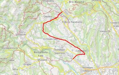
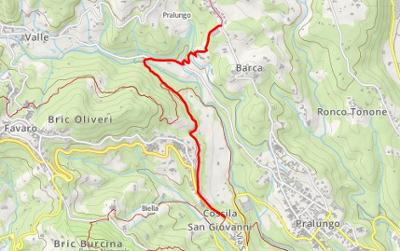
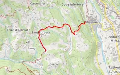
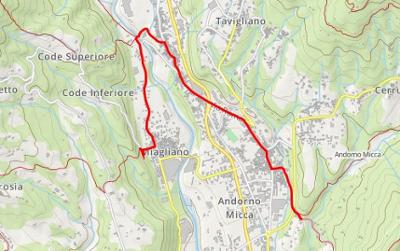
The Biella Circuit (GtB) is a route in 57 legs that we have divided into 15 daily sections. It can be broken down into a series of short trips, from daily outings for the less proficient to three-day hikes for experts.
The GtB is unusual among the assortment of larger Italian hiking circuits. It is a long ring that runs for the most part either at moderate heights or on the plain, and is well signalled and easily reached by public transport. The entire circuit can be completed in 15 consecutive days by staying in B&Bs, hotels or agritourism facilities along the route. Alternatively, it can be split up into sections of one or two days that you can select depending on the time you have available and your level of training.
Route
The GtB was created by the Province of Biella in 1996 by joining up into a single circuit a number of paths and carriageable roads that connect most the historical, naturalistic and devotional attractions in the area. Signposting was installed along the entire route (234 kilometres) in 1998, creating one of the longest signposted hiking routes in Italy. Much of the itinerary follows paths, cart-tracks and carriageable roads in a natural setting. Several sections follow paved roads but the very light traffic means there are no particular dangers for walkers. The GtB was designed to be for walkers only, with the result that nearly all of the legs have a part that cannot be cycled. The fittest and technically most prepared cyclists can tackle much of the hill section on mountain bikes (from Donato to Crevacuore), but it is strongly recommended that they avoid the high slopes and the mountain section, as often the paths are disconnected.
Signposting
The route can be recognised above all due to clearly seen yellow metal trail-markers placed on wooden stakes and marked with the logo GtB (Grande Traversata Biellese), or nailed on walls or other surfaces close to junctions. Remember that in such cases the markers are generally placed on the inside of the curve.
Sections
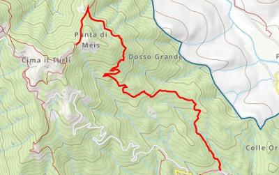
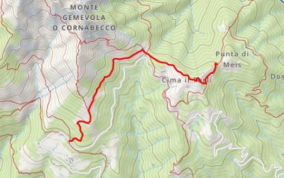
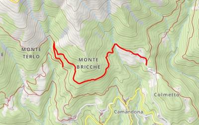
The route is divided up into 57 short legs, between 1 and 8 kilometres each, requiring between 20 minutes and 3 hours to complete. The departure and arrival points have been chosen close to points that can be reached by public transport, or where at least a car can be parked. Close to the carparking facilities, information panels give a short description of the section and a relevant map. The description of the route has been split into “sections” that can be walked in a single day. The technical description of the route gives the numbers of the legs involved, of which the start points can be seen on the maps of the Province of Biella.
Getting there
If you plan an excursion on the GtB of one or more days, you are advised to reach your start point taking the bus service from the city of Biella, and to choose your start and finish points in accordance with the times of the buses (see the website www.atapspa.it). Alternatively you can return to your start point but you are advised to consult good quality hiking maps so that you can decide on a circuit so as not to retrace your steps.
When to go
The entire route is at low to medium heights, so it can therefore be enjoyed at most times of the year. The highest point is reached on the Tracciolino (the last section) and is around the 1250 metre mark. Most of the rest of the circuit is at heights of less than 1000 metres, even in the mountain section. The best times to walk are between April and June, when the mountain section is made beautiful by the rhododendrons and narcissi in bloom, and in September- October, when autumn colours the woods and chestnuts can be gathered. If you decide to break your journey into sections, the mountain section (the coolest and shadiest) can even be enjoyed in July and August, the hottest months, and the hill and plain sections on good winter days without problem.
Equipment
You are advised to equip yourself for light hiking, with suitable boots and, for the most demanding mountain sections, telescopic hiking poles, which lighten the load on your knees and legs. Drinking water is generally available but in the mountain sections it is not always certain that you will find somewhere to provide lunch, so check before you set out and take food with you if you are unsure.
57 results

_2.jpg/ccd1ed94-342b-4302-b0b0-c56381509794?t=1542097831341)
_2.jpg/c9b0385d-1726-47d4-a1ff-56cf4144b7c0?t=1542097878911)
 Pettinengo_2.jpg/98ba5983-4f9e-4778-990f-71c5206ce1d3?t=1542097863357)
_2.jpg/4272ff1a-1081-4ae7-9f93-c9ce46250155?t=1542097890466)
 Baraggia di Candelo_2.jpg/4ba30129-f0ea-4089-a495-cb18a507b298?t=1542097907379)
_2.jpg/e3ea25ad-40d7-4170-b9d4-4d4359ba6cd2?t=1542097882947)
 SVincenzo chiesa (Mottalciata)_2.jpg/0ebaabbf-94c9-4ab5-829a-4f9b36cacb9c?t=1542097903234)
 Terzoglio (Castelletto Cervo)_2.jpg/5092d6ed-540a-4fd7-abb6-5d2222743124?t=1542097894430)
 Lessona_2.jpg/1032418d-fe4c-4221-9ba5-23db8b5958c0?t=1542097886788)
_2.jpg/9414c434-e056-4516-860a-2ef6ede9582e?t=1542097931339)
 Asei_2.jpg/8bf380ce-442d-4eef-abaf-c68ca606b25a?t=1542097922744)
 Coggiola_2.jpg/30620bed-043c-4727-a78b-7b30827d482d?t=1542097938900)
 Castagnea (Portula)_2.jpg/e76bd63e-a62b-4b6d-8f80-83676e915473?t=1542097987748)
 Santuario della Brughiera (Mosso)_2.jpg/94199664-8623-4448-a546-29666ee9358a?t=1542097965262)
 Capomosso (Mosso)_2.jpg/35a6bf71-f6a1-40d0-b3ac-fd01f5c154fb?t=1542097992236)
 Piane di Veglio_2.jpg/f50d8ba2-565a-4dd3-9975-7be74d519cd9?t=1542097960409)
 Trabbia (Callabiana)_2.jpg/60dd6e58-afe1-407a-a2fa-1f3b572d7934?t=1542097969202)
 Pratetto (Tavigliano)_2.jpg/62d3cc24-4666-405c-aa2f-78dbe053f2f2?t=1542097974650)
 Falletti (Sagliano)_2.jpg/e71952f5-20d7-4bd4-8926-74009028fac8?t=1542097983610)
 Quittengo_2.jpg/6a659184-707d-438f-b7f5-aba310b4fdf1?t=1542098382925)
_2.jpg/3b121757-33d6-4b8b-ab89-d6172c8657f5?t=1542098386652)
 Oneglie (Sagliano)_2.jpg/3f1bda3a-3312-4698-91d8-e4ab0baf820e?t=1542098366444)
 Oropa_2.jpg/85fcb3a4-d96d-41fe-b435-e81e5740b908?t=1542098015849)