GTB Section 04: Viverone - Cerrione
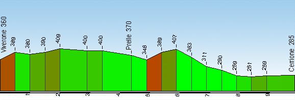
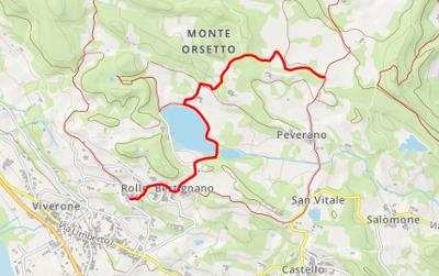
Start: Viverone, Borgata Rolle (360 m)
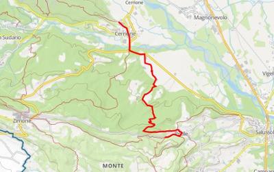
Finish: Cerrione (285 m)
GtB legs: 11-13
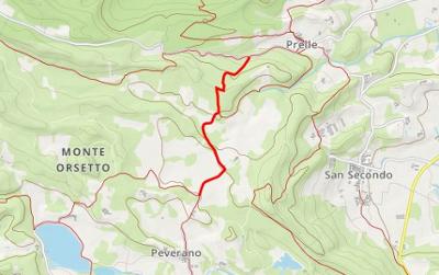
Passing through: Prelle (370 m)
Length: 10 km
Ascents and descents: 170 m (climb) 245 m (descent)
Time required: 3h20'
Difficulty: T - (Easy)
Comments: The itinerary crosses the morainic hills north of Lake Viverone, in which the series of woods and fields is interrupted by two lovely spots: Lake Bertignano and the ruins of the Church of Santa Elisabetta. The village of Cerrione is overlooked by the ruins of a thirteenthcentury castle destroyed by a German bombardment during WW2 when it was used as a base for partisan operations.
Leave Rolle in the direction of Lake Bertignano. Keep the lake on your left, and take a paved road that rises towards Cascina Vanotta where a cart-track heads into the wood. Shortly afterwards, take care to continue straight on at a junction (not easily visible) by a sharp turn on the right. You will come to another junction by the ruins of the Church of Santa Elisabetta, here you turn left. At Cascina San Lorenzo turn left again, follow the enclosure wall and enter the wood. You will pass along a series of disconnected cattle-tracks and cart-tracks until you come to a carriageable road that leads to the Zimone-Salussola road. When you come to a bend to the left close to the village of Prelle, leave the paved road along a cattle-track that is not easy to see but which passes through an orchard on the left. You climb towards the wood and take a path that goes steeply down to a cart-track that leads towards Cascina San Michele. Take take care to follow the path to the left that runs alongside a row of trees. After a stretch of this path, you will notice a cart-track on the left that leads to a wide carriageable road and the paved road to Cerrione.
3 results

