escapedSiteName:Guest
errorType:
errorCode:
errorMsg:
hasLayoutCustomizePermission: false
hasLayoutUpdatePermission:false
refererPlid: 0
backURL:
toggleControlsState:visible
showAddControls:false
showEditControls: false
showPreviewControls: false
showToggleControls: false
userSetupComplete: false
showAdminLinks: false
portalMessageUseAnimation: true
hasLayoutCustomizePermission: false
setHasLayoutUpdatePermission: false
toggleControlsState: visible
openSiteMapUrl: https://www.atl.biella.it/en/trekking/gtb/tratta-7-pollone-zumaglia?p_p_id=145&p_p_lifecycle=0&p_p_state=pop_up&p_p_mode=view&_145_stateMaximized=true&_145_selPlid=1935387&_145_struts_action=%2Fdockbar%2Fadd_panel&_145_closeRedirect=%2Fsuggesto-gui-portlet%2Fhtml%2Fclosewindow.html
openEditPageUrl: https://www.atl.biella.it/en/trekking/gtb/tratta-7-pollone-zumaglia?p_p_id=145&p_p_lifecycle=0&p_p_state=pop_up&p_p_mode=view&_145_selPlid=1935387&_145_struts_action=%2Fdockbar%2Fedit_layout_panel&_145_closeRedirect=%2Fsuggesto-gui-portlet%2Fhtml%2Fclosewindow.html

GTB Tratta 07: Pollone - Zumaglia
Start: Pollone (620 m)
Finish: Zumaglia (620 m)
GtB legs: 21-27
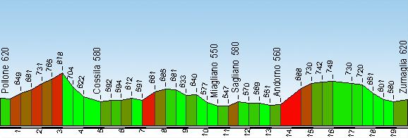
Passing through: Cossila San Giovanni (580 m) Miagliano (550 m) Sagliano Micca (580 m) Andorno Micca (560 m)
Length: 20.5 km 
Ascents and descents: 710 m (climb) 710 m (descent)
Time required: 7 hours
Difficulty: E - (Average)
Comments: The colours, views and exotic atmosphere of Burcina Park make this one of the most beautiful sections of the entire Biella Circuit. Creation of the garden was begun in 1840 by the Piacenza family, textile manufacturers from Pollone. 

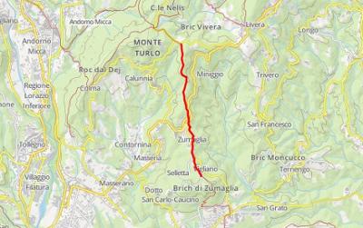
In crossing Burcina Park you climb up to the Martini Tower. From here a mixture of paths and paved roads heads down to the Rio Bolume valley until it reaches the road to Pollone. Take the steep path up to the cemetery of Cossila San Giovanni and turn left towards Oropa. Leave the main road in the direction of the pic-nic area of Antua, continue on the dirt road to the bridge over the Oropa Torrent and cross over. Now turn right onto the Pralungo-Favaro road. A path between the fields leads to the village of Sant’Eurosia. Descend towards the Rio Stono, cross it and climb up to Bazzera. Take the mule-track into the wood to the paved road that leads to Miagliano. Continue to the Torrent Cervo , which you can cross on a walkway, and continue to the lovely Oratory of the Santissima Trinità. From here a mule-track rises towards the old centre of Sagliano Micca from where you continue to Andorno Micca. Now take the cart-track that rises with sharp turns into the wood towards Colma. After passing through the woods of Mount Turlo, you come to a paved road. Turn right and shortly after the junction for Vaglio take the cart-track that leads into the wood . This will take you to Zumaglia.  

7 results

Biella (Biella and Oropa Valley) - Pollone (Elvo Valley)

Itinerary type: GTB itinerary

Means of transport: On foot

Length (km): 5.22

Uphill height difference(m): 240

Travel time: 1 hour 15 minutes

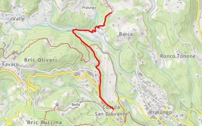
Biella, Pralungo (Biella and Oropa Valley)

Itinerary type: GTB itinerary

Means of transport: On foot

Length (km): 2.66

Uphill height difference(m): 90

Travel time: 1 hour

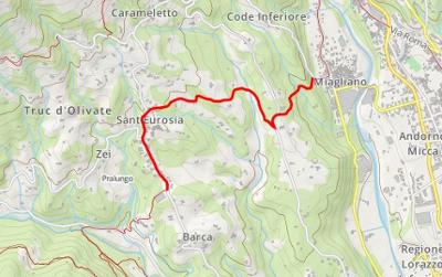
Pralungo (Biella and Oropa Valley) - Miagliano, Sagliano Micca, Tollegno (Cervo Valley)

Itinerary type: GTB itinerary

Means of transport: On foot

Length (km): 2.6

Uphill height difference(m): 80

Travel time: 45 minutes

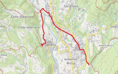
Miagliano, Sagliano Micca (Cervo Valley)

Itinerary type: GTB itinerary

Means of transport: On foot

Length (km): 3.63

Uphill height difference(m): 65

Travel time: 45 minutes

Andorno Micca (Cervo Valley)

Itinerary type: GTB itinerary

Means of transport: On foot

Length (km): 1.19

Uphill height difference(m): 130

Travel time: 50 minutes

Selve Marcone (Mosso Valley) - Pettinengo (Brich di Zumaglia and Biellese Hill) - Andorno Micca (Cervo Valley)

Itinerary type: GTB itinerary

Means of transport: On foot

Length (km): 2.48

Uphill height difference(m): 65

Travel time: 1 hour

Pettinengo, Zumaglia (Brich di Zumaglia and Biellese Hill)

Itinerary type: GTB itinerary

Means of transport: On foot

Length (km): 2.7

Uphill height difference(m): 40

Travel time: 3 minutes

Do you want to receive our Newsletter?

Subscribe to our newsletter to receive latest news.