escapedSiteName:Guest
errorType:
errorCode:
errorMsg:
hasLayoutCustomizePermission: false
hasLayoutUpdatePermission:false
refererPlid: 0
backURL:
toggleControlsState:visible
showAddControls:false
showEditControls: false
showPreviewControls: false
showToggleControls: false
userSetupComplete: false
showAdminLinks: false
portalMessageUseAnimation: true
hasLayoutCustomizePermission: false
setHasLayoutUpdatePermission: false
toggleControlsState: visible
openSiteMapUrl: https://www.atl.biella.it/en/trekking/itinerari-valsessera?p_p_id=145&p_p_lifecycle=0&p_p_state=pop_up&p_p_mode=view&_145_stateMaximized=true&_145_selPlid=1935447&_145_struts_action=%2Fdockbar%2Fadd_panel&_145_closeRedirect=%2Fsuggesto-gui-portlet%2Fhtml%2Fclosewindow.html
openEditPageUrl: https://www.atl.biella.it/en/trekking/itinerari-valsessera?p_p_id=145&p_p_lifecycle=0&p_p_state=pop_up&p_p_mode=view&_145_selPlid=1935447&_145_struts_action=%2Fdockbar%2Fedit_layout_panel&_145_closeRedirect=%2Fsuggesto-gui-portlet%2Fhtml%2Fclosewindow.html
emailTo infobiella@terrealtopiemonte.it

ITINERARIES IN “VALLE SESSERA”


The Valsessera branch of the "CAI" (Italian Alpine Club) suggests some easy itineraries over fairly leisurely courses or, alternatively, more challenging routes for the more expert hiker. These itineraries present no particular technical difficulties and can be modified by anybody, according to their own requirements and according to the weather conditions, provided they follow the signposted paths and use:
 

  • Trail Map – North-eastern and Central-eastern Biella region, Province of Biella, 2004 edition (1:25,000);
  • Guide to the excursion itineraries of Valsesia, sheets 6/A, 6/B of C.A.I. Varallo.

All information on the itineraries is to be found on the new portal of the "Comunità Montana Valle Sessera" (Sessera Valley Mountain Community), in the special section dedicated to itineraries, www.vallesessera.it/itinerari.php

7 results

Coggiola, Portula (Zegna Oasis and Sessera Valley)

GEOTOURISM IN VALSESSERA: RING OF SANCTUARIES

Itinerary type: Excursion

Means of transport: On foot

Length (km): 16.14

Uphill height difference(m): 761

Travel time: 5 hours 30 minutes

Difficulty: Easy

Caprile, Coggiola (Zegna Oasis and Sessera Valley)

GEOTOURISM IN VALSESSERA: ALONG THE LITTLE SWITZERLAND OF BIELLESE

Itinerary type: Excursion

Means of transport: On foot

Length (km): 14.69

Uphill height difference(m): 1733

Travel time: 7 hours 35 minutes

Difficulty: Medium

Ailoche, Caprile, Crevacuore (Zegna Oasis and Sessera Valley)

GEOTOURISM IN VALSESSERA: FROM THE FOXES TO THE HEART

Itinerary type: Excursion

Means of transport: On foot

Length (km): 9.30

Uphill height difference(m): 0

Travel time: 3 hours 30 minutes

Difficulty: Medium

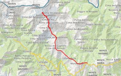
Campiglia Cervo, Piedicavallo (Cervo Valley)

UPPER VALSESSERA RING: FIRST STAGE

Itinerary type: Excursion

Means of transport: On foot

Length (km): 9.87

Uphill height difference(m): 1380

Travel time: 6 hours

Difficulty: Medium

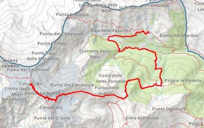
Pettinengo, Bioglio, Valle San Nicolao (Brich di Zumaglia and Biellese Hill) - Piedicavallo (Cervo Valley)

UPPER VALSESSERA RING: SECOND STAGE

Itinerary type: Excursion

Means of transport: On foot

Length (km): 11.88

Uphill height difference(m): 80

Travel time: 3 hours 15 minutes

Difficulty: Expert

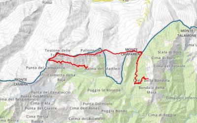
Trivero (Zegna Oasis and Sessera Valley) - Pettinengo (Brich di Zumaglia and Biellese Hill)

UPPER VALSESSERA RING: THIRD STAGE

Itinerary type: Excursion

Means of transport: On foot

Length (km): 15.70

Uphill height difference(m): 1300

Travel time: 7 hours

Difficulty: Expert

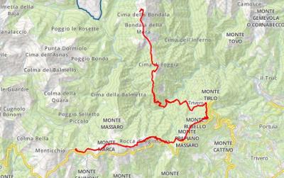
Portula, Trivero (Zegna Oasis and Sessera Valley) - Callabiana, Mosso (Mosso Valley)

UPPER VALSESSERA RING: FOURTH STAGE

Itinerary type: Excursion

Means of transport: On foot

Length (km): 19.3

Uphill height difference(m): 1275

Travel time: 9 hours

Difficulty: Expert

Do you want to receive our Newsletter?

Subscribe to our newsletter to receive latest news.